Day 44 - Walking the Via Francigena - Métabief To Orbe, Switzerland - A Challenging Day On The Roman Road, A Hike Through An Ancient Forest, Alien Crop Circles, A Traditional Cow Parade And Crossing The Jura Mountains


Day 44 - Walking the Via Francigena - Métabief To Orbe, Switzerland - A Challenging Day on The Roman Road, A Hike Through an Ancient Forest, Alien Crop Circles, A Traditional Cow Parade and Crossing The Jura Mountains
Today we crossed over into Switzerland.
It was a challenging day with much climbing and descending.
We had two options for our walk today.
One option was to climb to the top of the Jura Mountains in Métabief, and then to walk along the paved road to Orbe.
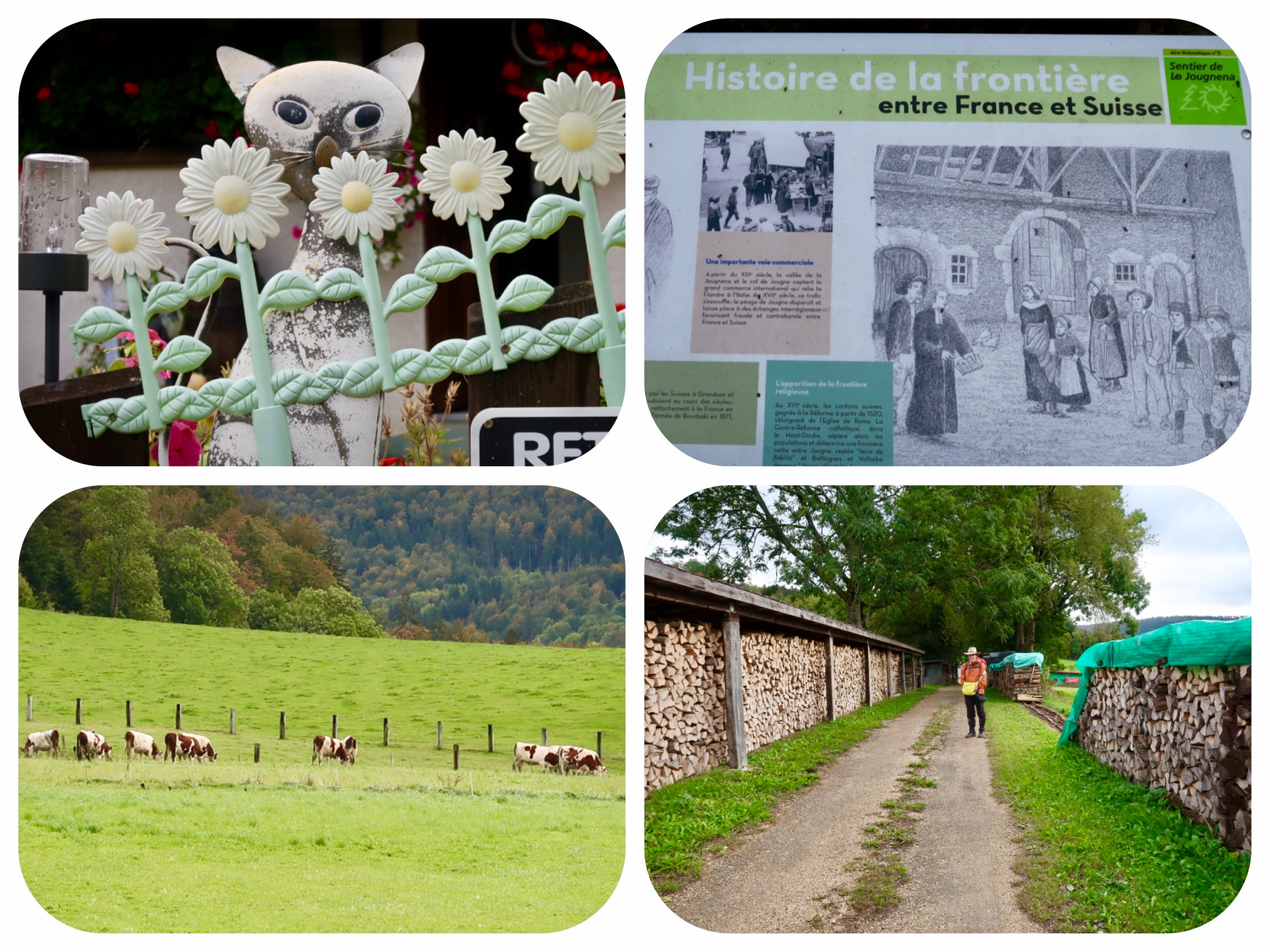
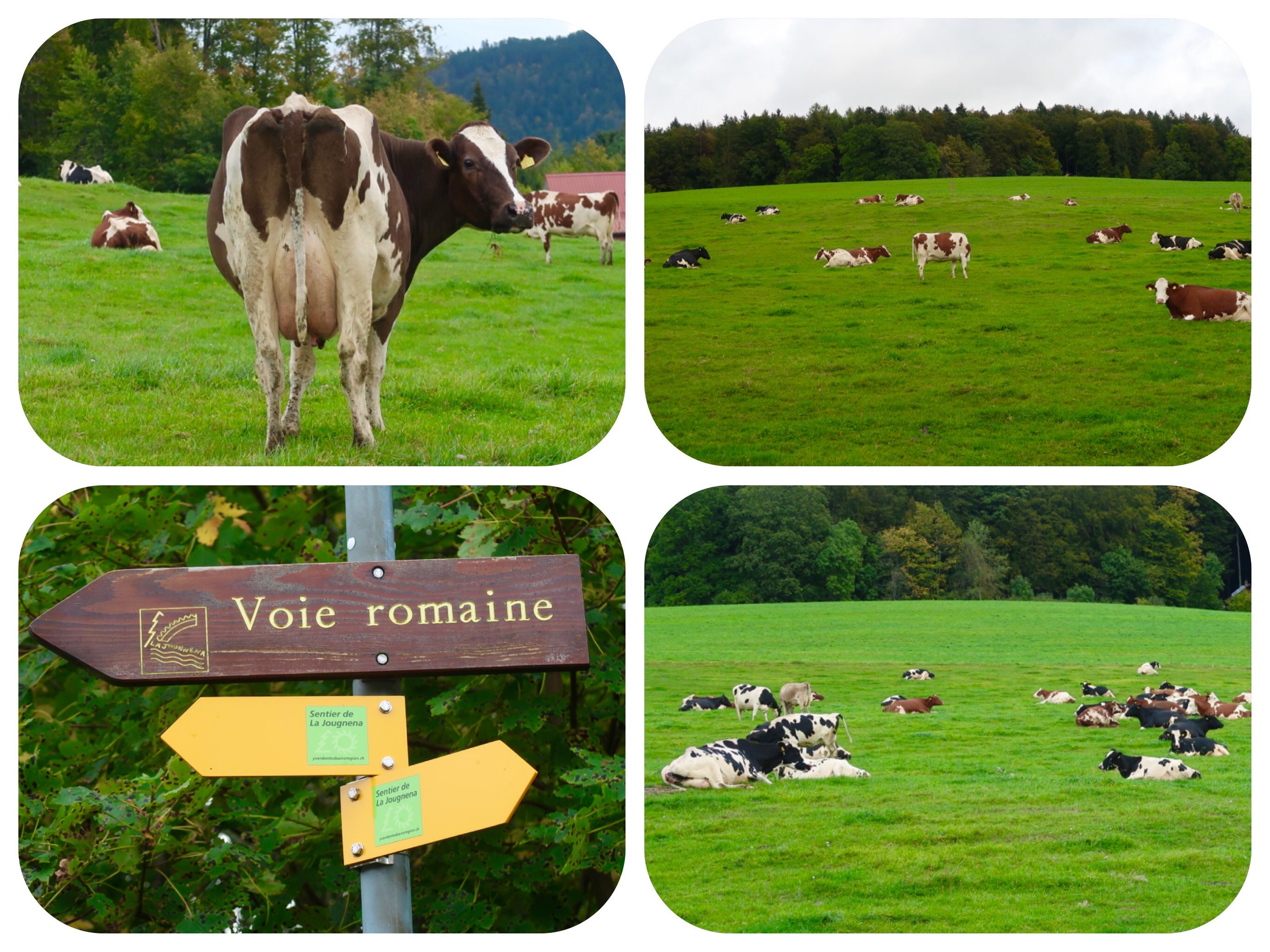
The second option was to walk about five kilometers to the nearby town of Jougne, and then to pick up the Via Francigena path that follows the old Roman road of Julius Caesar, locally known as the road of Jules César.
Then the Roman path splits from the Via Francigena.
The Roman road climbs up into the mountains, and the Via Francigena follows the Orbe river all the way through a vast canyon, until it reaches the Orbe Gorge and then, finally, the town of Orbe.
We chose the second option.
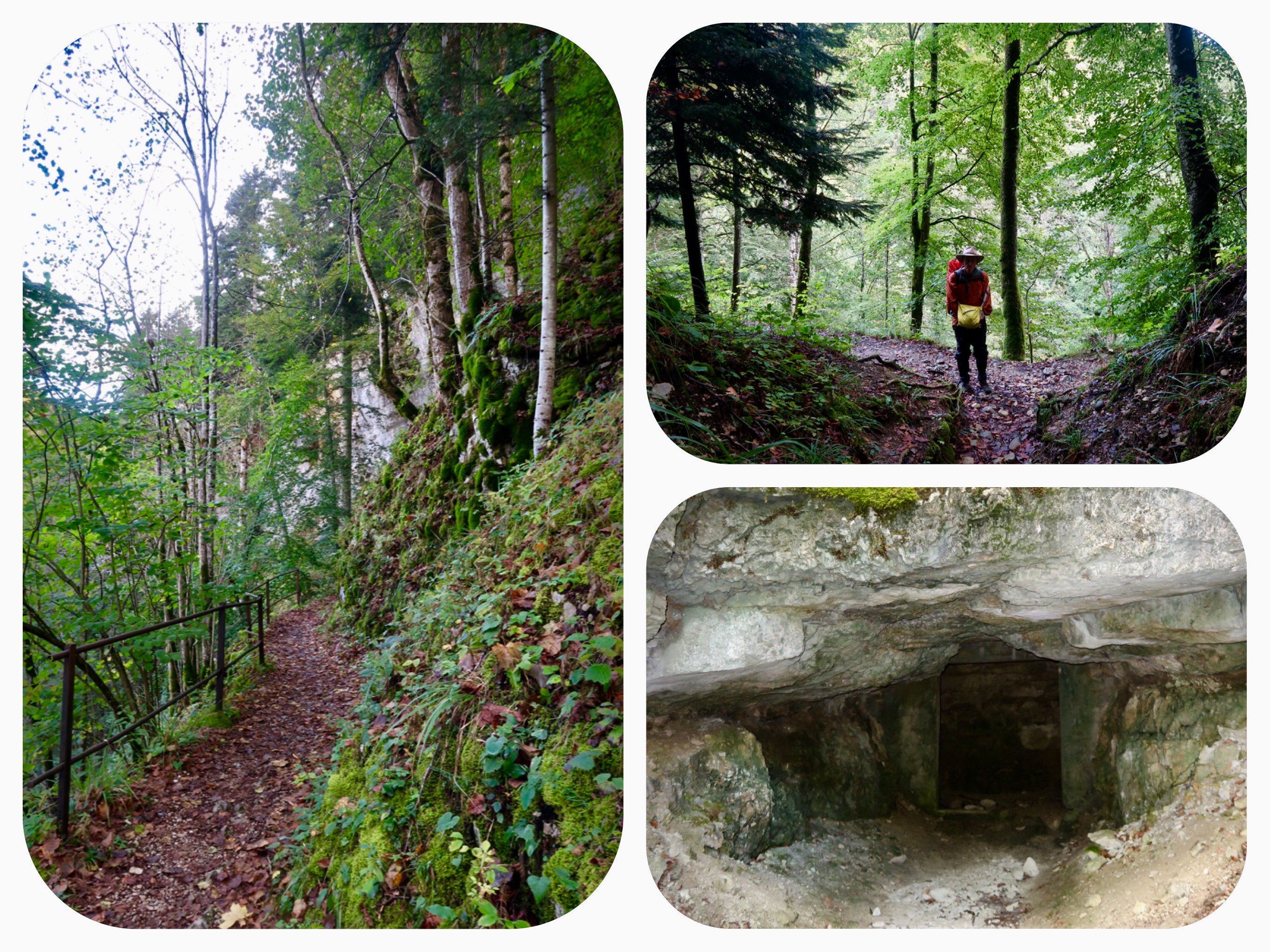
We walked to Jougne and then started walking down a very steep slope leading to the river, on the Via Francigena.
It was raining, and the steep path down was very slippery.
We had to hold hands and walk together in order to provide better support.
We passed by an old church called Chapelle Saint Maurice, which was mentioned in writings as early as the year 990 AD.
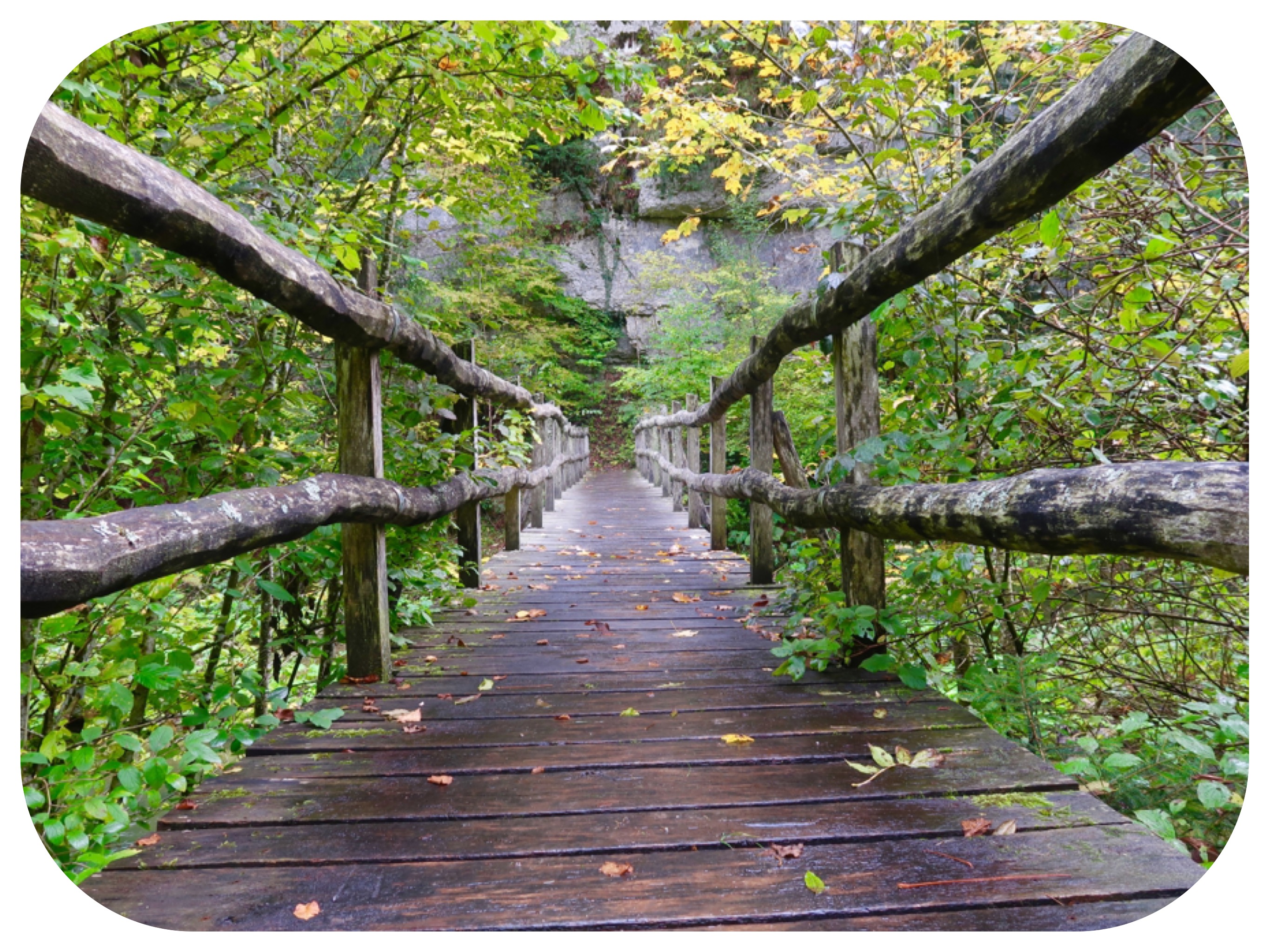
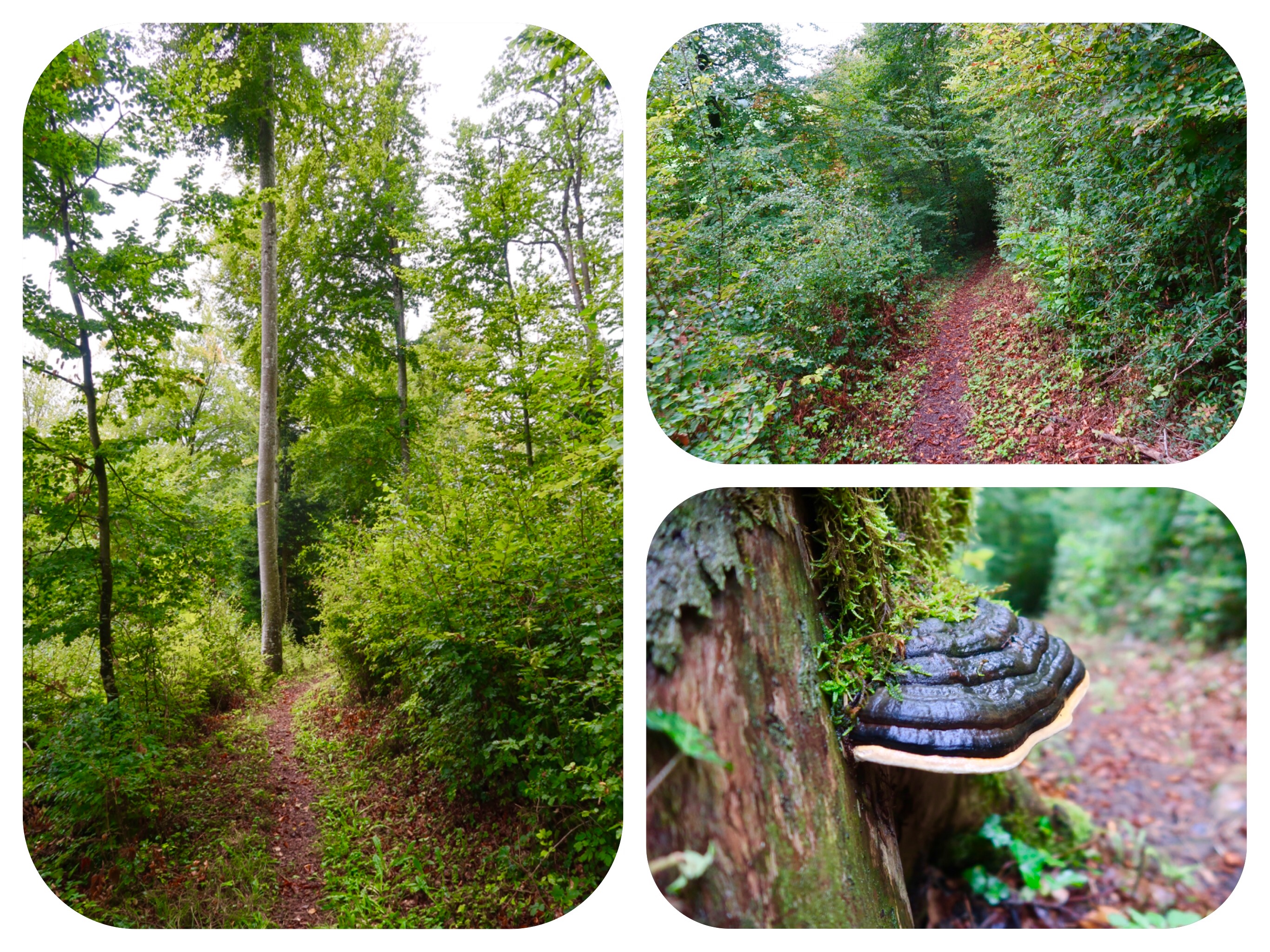
The descent to the river was on a very steep slippery forest path.
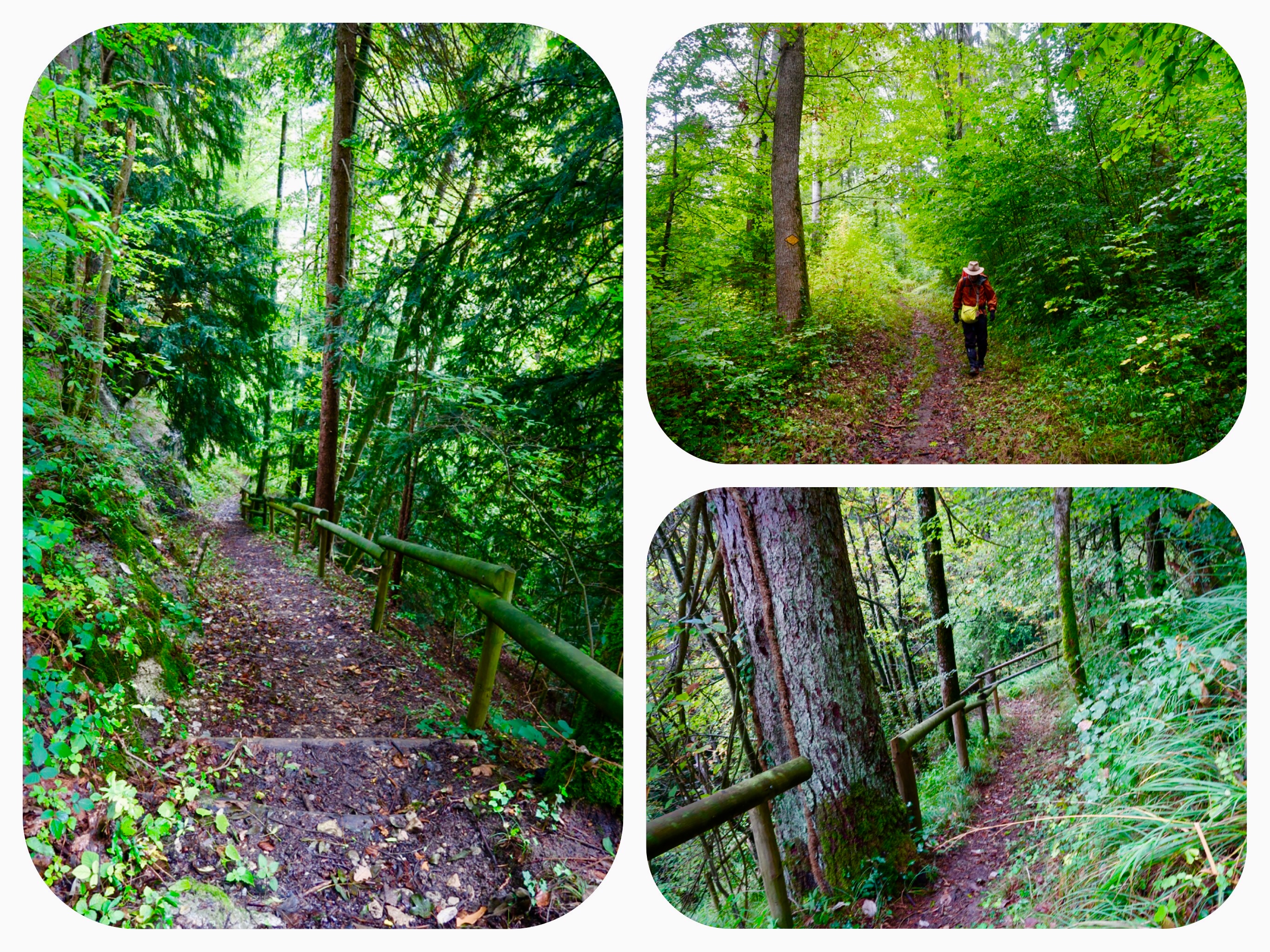
At times, there were wooden steps with log railings, which made the descent a bit easier.
From there, the path climbed and descended all day long.
It was cold and raining, and then it turned warmer, and finally in the late afternoon, it stopped raining.
It was challenging to climb up and down this forest hike in the rain.
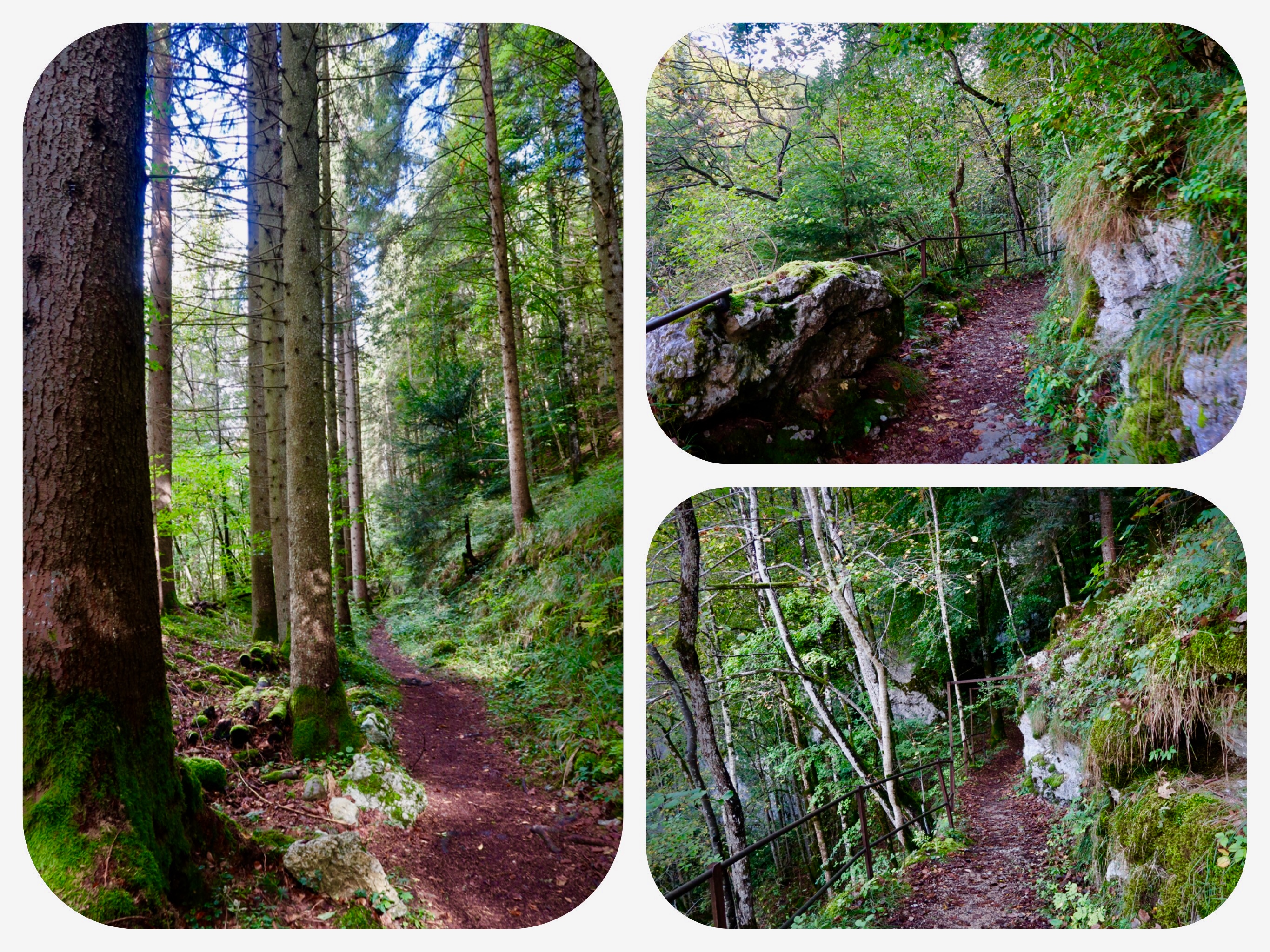
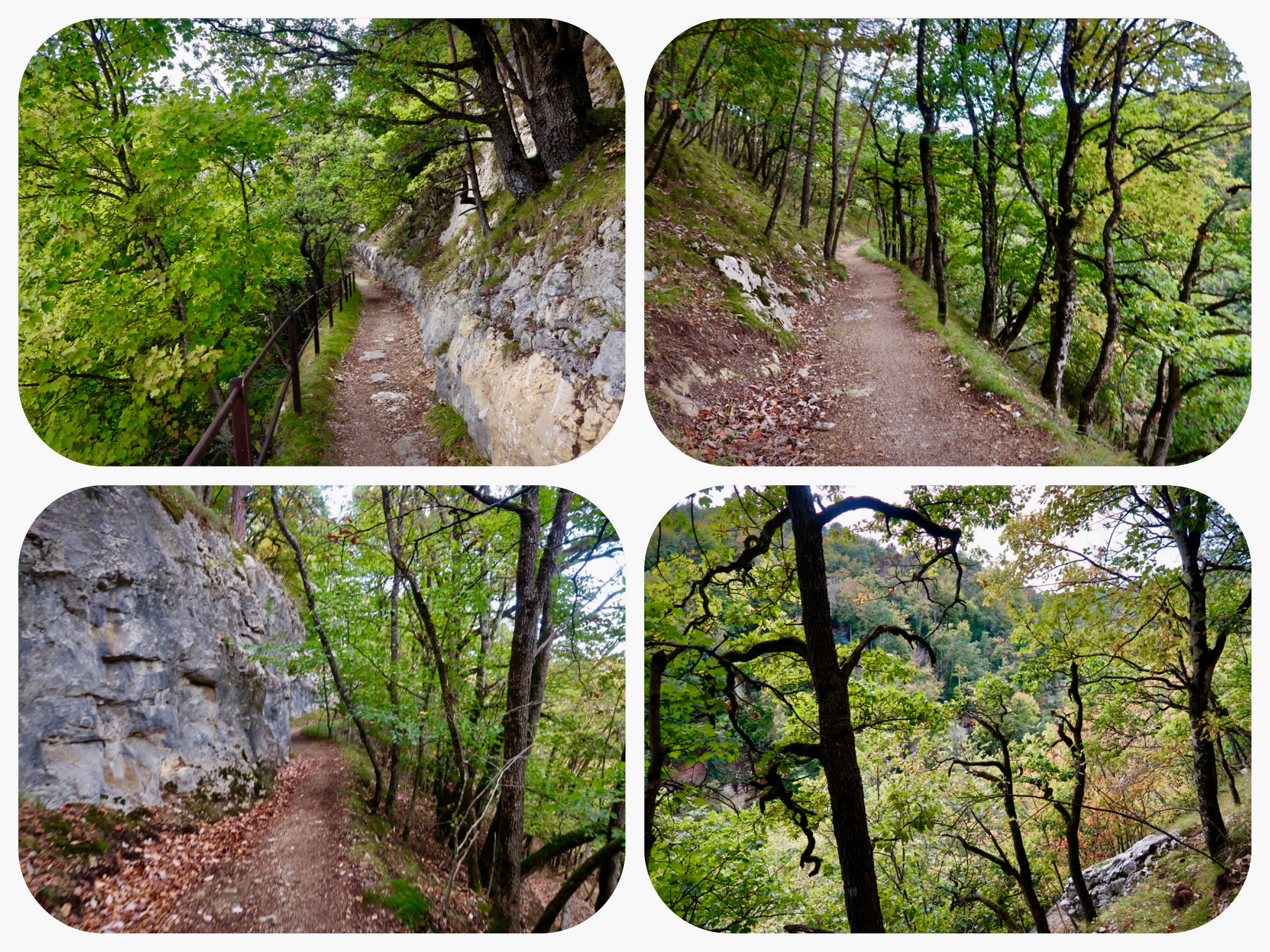
The forest path was beautiful, often crossing over tree roots and hugging the edges of cliffs. It frequently descended to cross over the river on small wooden bridges, and then ascended again.
When we reached the Swiss border, there was a sign saying this was an old border crossing path, once used by local traders.
There were neither guards nor a border crossing booth to check our documents.
A few cows yawned at us, quite uninterested.
I asked the cows if they considered themselves French or Swiss, but they did not find my question amusing.
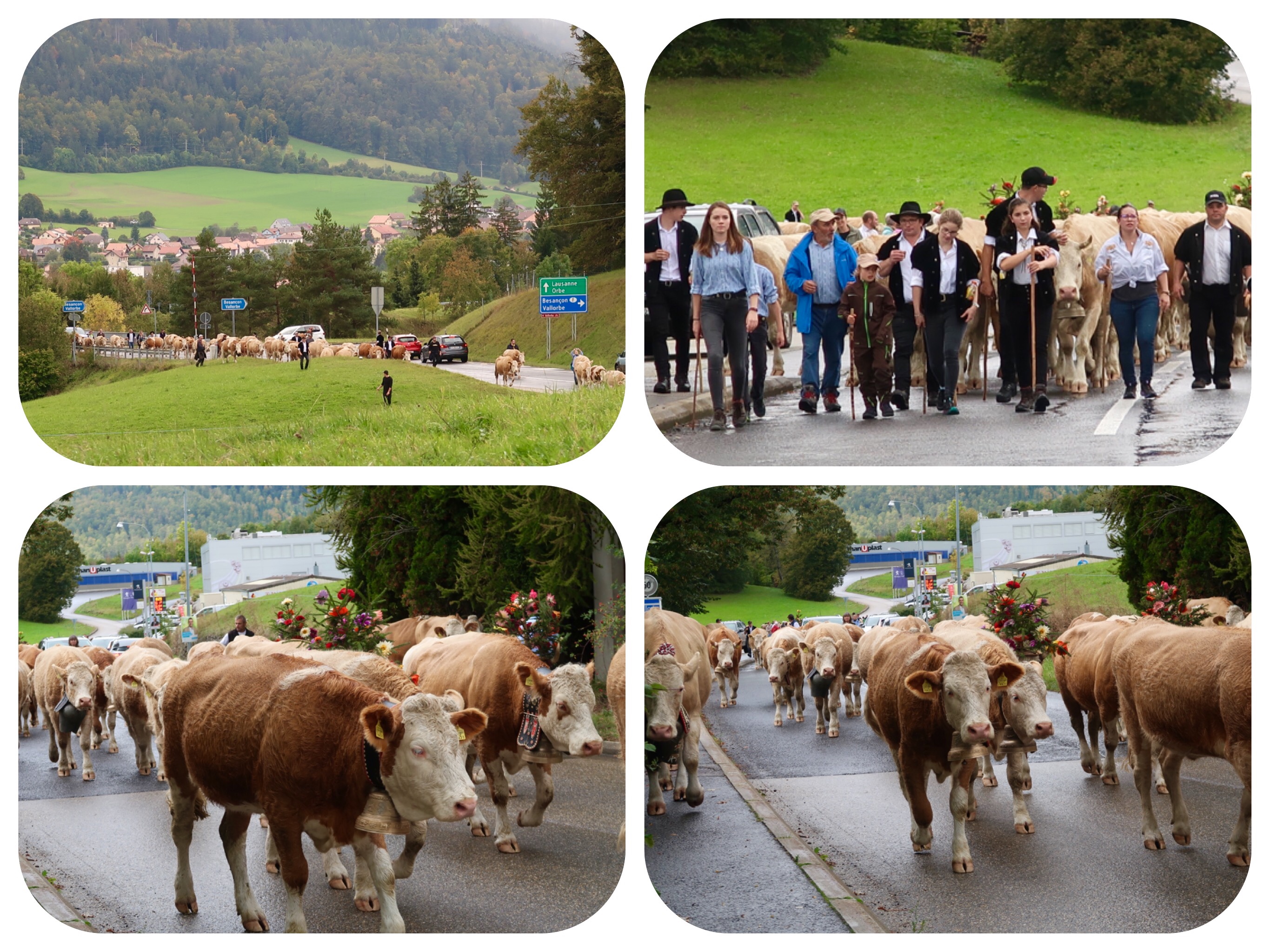
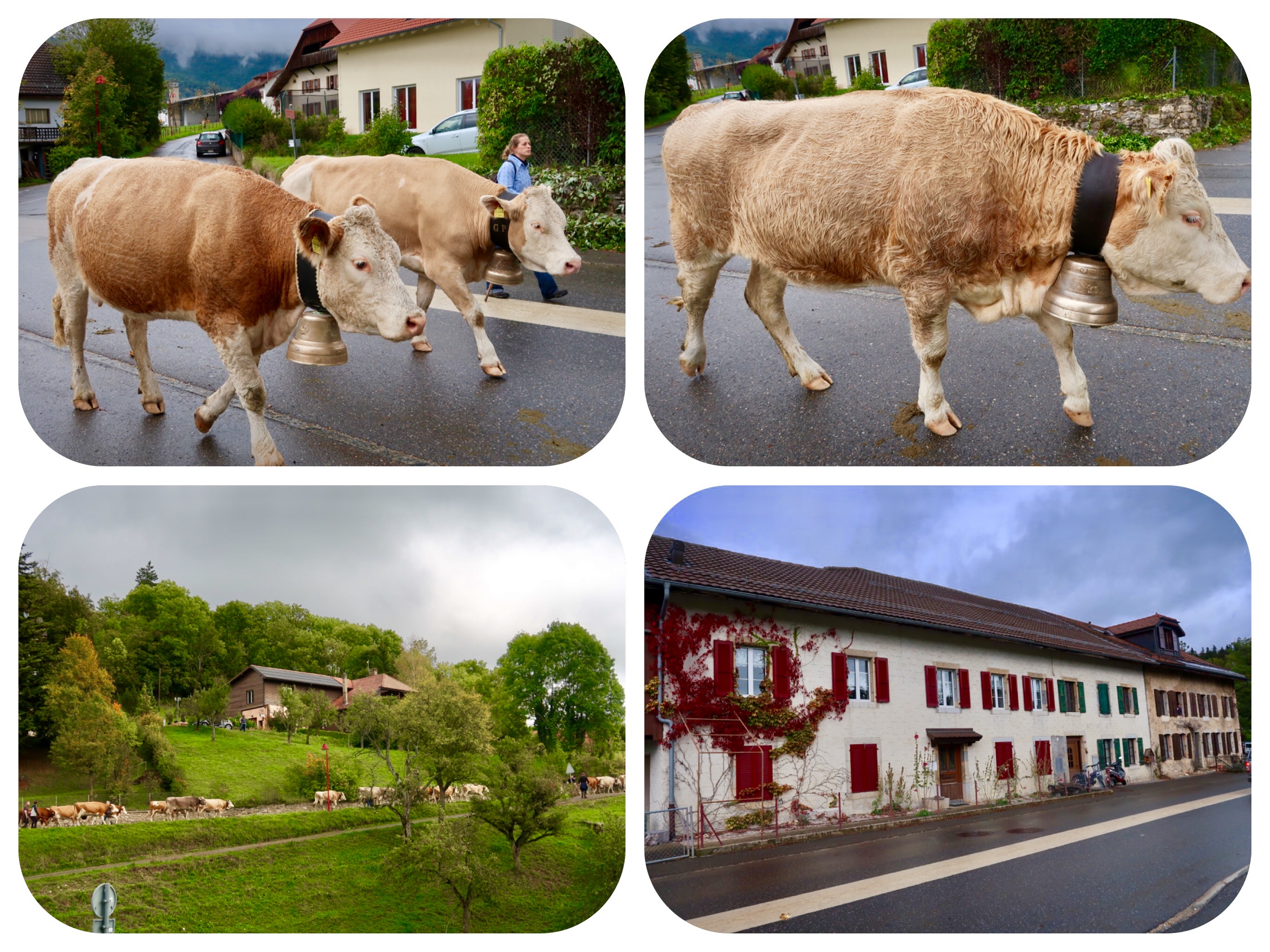
When we reached the village of Ballaigues, we heard a symphony of cowbells ringing in the street.
We saw a large parade of hundreds of cows, and people in traditional clothing walking the cows through the streets of the village.
Many of the cows wore flowers on their heads and large heavy ceremonial bells that dangled from their necks.
We hurried down the mountain to meet the parade on the road.
It was quite a sight.
The decorated cows looked awesome and their deep mooing voices mixed with the ringing of the big brass bells.
This cow parade happens all over Switzerland once per year, and we were very lucky to have seen it today.
It is called “Désalpes” or “Alpabzug,” meaning “Alpine descent.”
In Switzerland, the milking cows are walked down from their summer alpine pastures, to their winter barns before the snows come.
As the cows come down the mountain trails to the village streets, the people line the streets to greet the colorful line of marching people and cows.
The processions of cows crowned with flowers and with huge clanging bells, are led by cowherds dressed in embroidered traditional jackets and dresses.
This end-of-summer tradition has been taking place in Switzerland since about 3000 BCE.
It’s a festive time now, but wasn’t always.
Turf wars over alpine grazing rights took place here as early as 1315 AD.
There were disputes over access to pastures, and citizens from the canton of Schwyz raided the Habsburg-protected Einsiedeln Abbey. The Austrian Habsburgs invaded, having already had their eye on the nearby Gotthard Pass, the shortest route to Italy.
The Swiss soldiers defeated the Austrians, earning the gratitude of generations of Swiss dairy cow herders.
Today, festivities included more than pretty cows on parade.
In some villages, visitors will hear Alpine horns and yodeling, and see traditional dancing, flag-throwing competitions and men marching in unison to the tune of the cowbells around their necks.
Regional crafts and foods are also offered, including of course cheeses made from those beautiful cows passing by that day.
I noticed that the Sim card that I had bought in France and was promised to work all over Europe, has stopped working.
It was time for lunch and to figure out what was going on with my phone.
The Hôtel-Restaurant Croix d'Or in Ballaigues, has a very cool cafe and restaurant.
We stopped in and enjoyed a great lunch.
I had the grilled vegetable salad and a dessert of chocolate fondant, a small warm chocolate pastry that oozed hot chocolate as I cut it open.
I was not able to resolve my SIM card problem.
It turned out that Switzerland is not part of our SIM network plan, and so we will need to get a Swiss SIM card.
For now, we will have to follow the Via Francigena signs through the forest, until we get to Orbe.
I also downloaded the map of today’s route, to use if I lose cell reception.
It should work well enough to get us to Orbe.
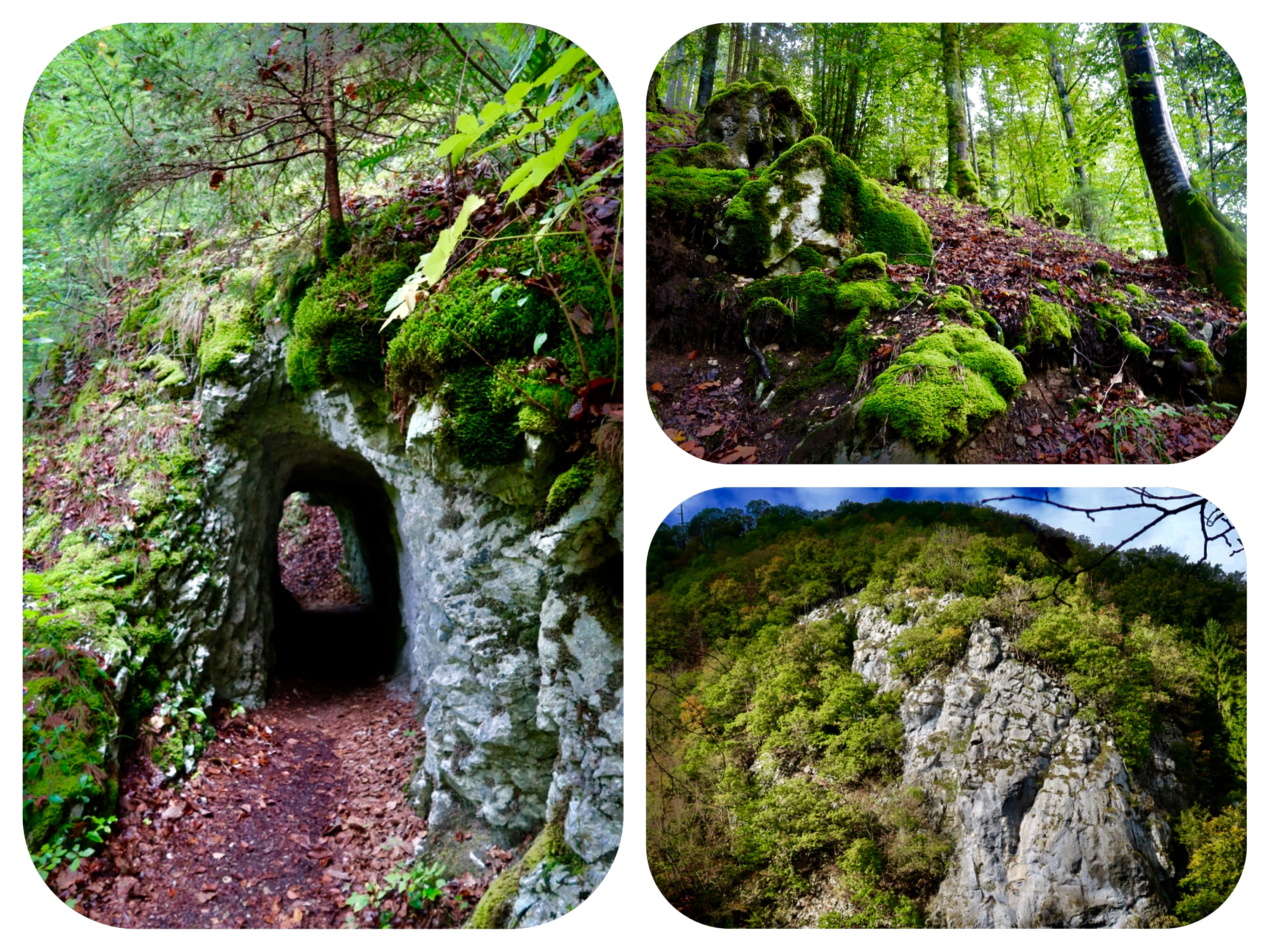
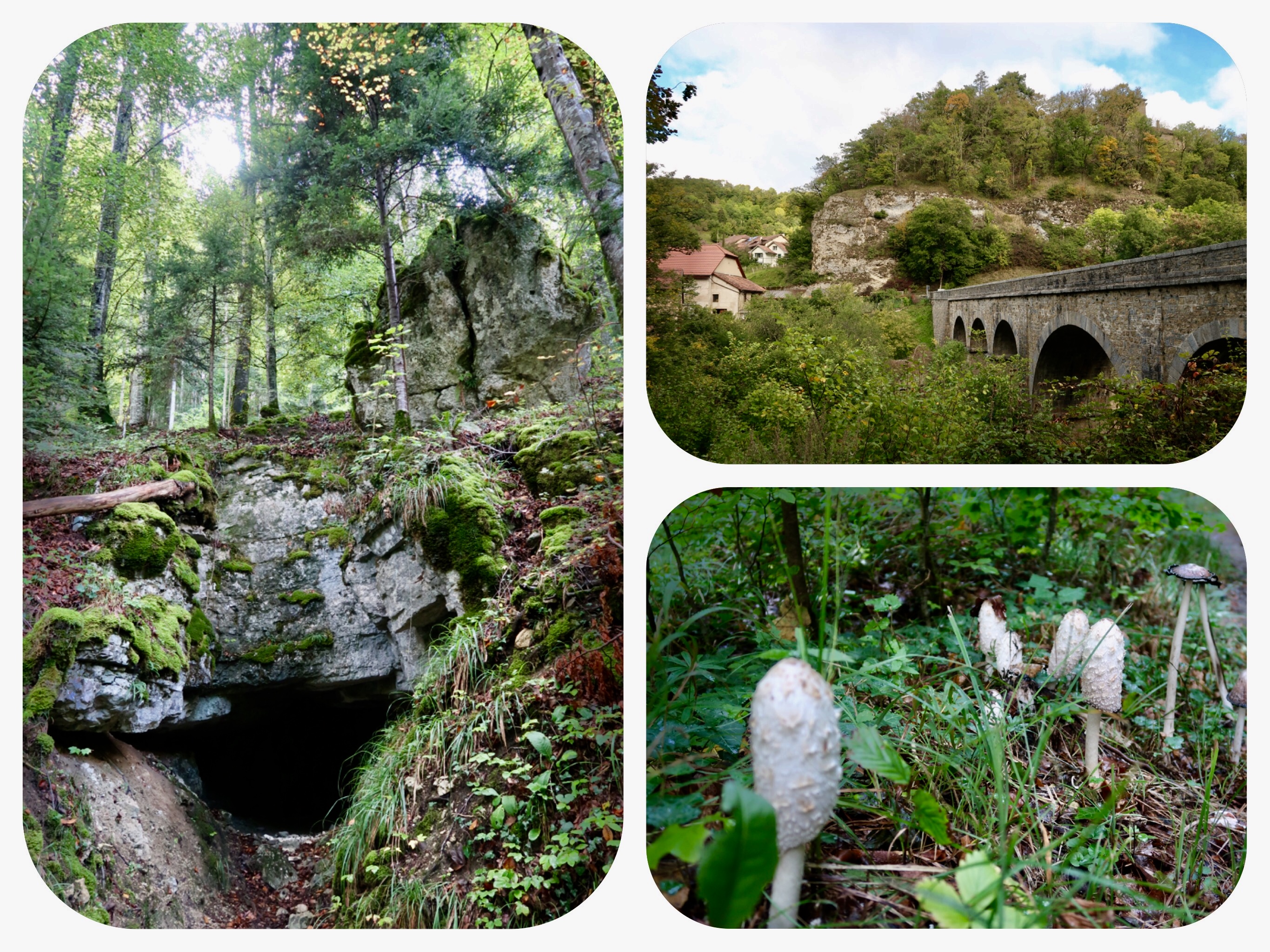
The forest path was beautiful, with ancient trees and stone walls dating back to the Roman era.
But the most beautiful part of this walk above the Orbe river, were the caves and stone tunnels carved into the rocks.
They were short and obviously just big enough for people walking, but they were beautiful as we circulated around the high cliffs of the canyon.
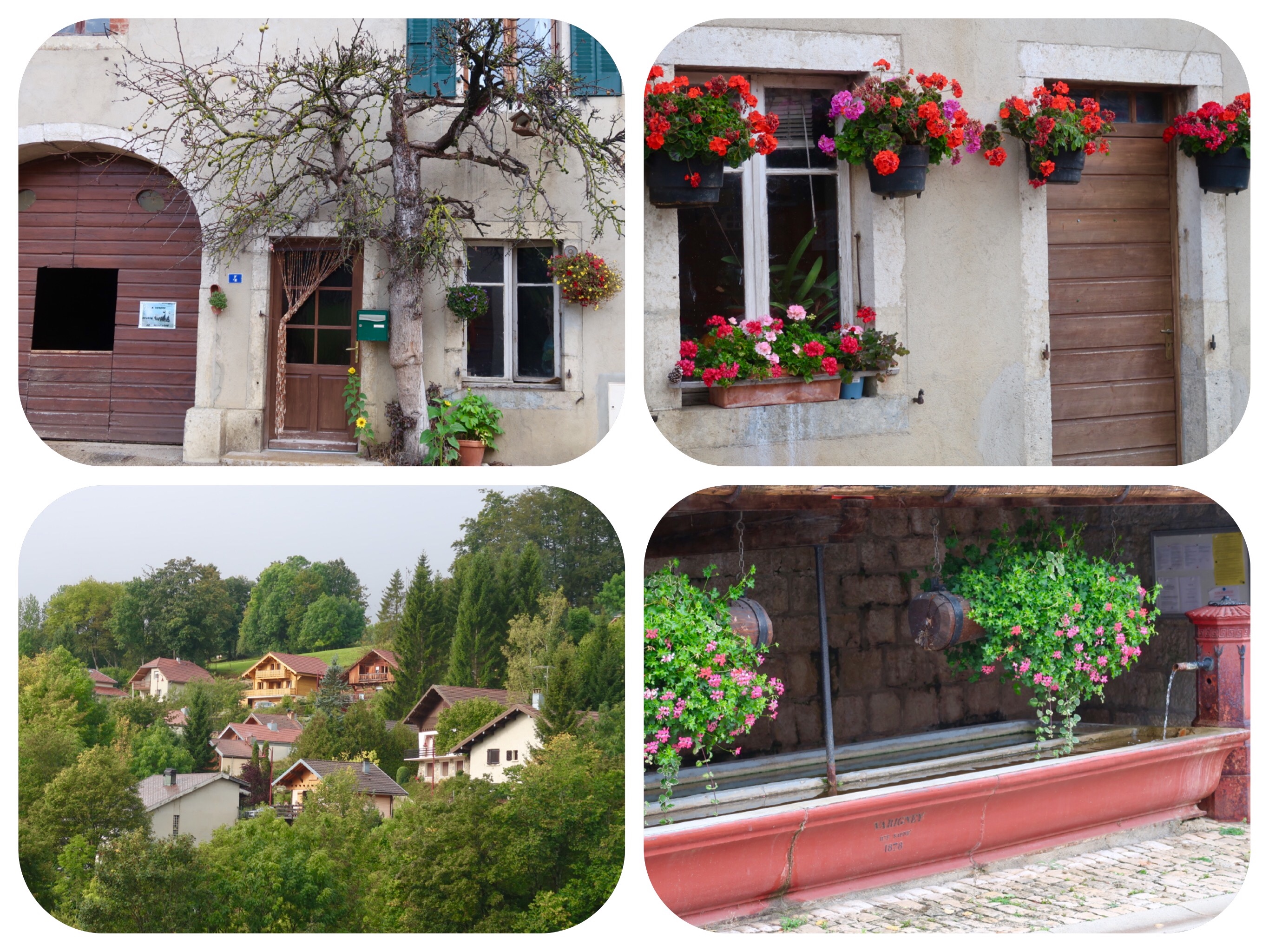
We got out of the forest into a small village before entering another forest.
At the edge of the forest, I saw two interesting things.
One was a small group of Ibexes.
An Ibex is a species of wild goat that looks a bit like a deer.
They live in the wild in the Jura and in the Alps.
They skipped out of sight when I arrived, before I had a chance to take their photo.
The second sight I saw was a wild grassy patch of ground with “Crop Circles” in them.
It was not farm land, and the appearance of the the circular indentations in the wild grass, was most definitely man made.
It looked as if someone had landed an alien craft or built a round yurt on the grass, except it was a very unlikely location, at the edge of a cliff and a forest.
Made me wonder in amazement.....
I remembered reading the books of Billy Meier, a Swiss man who is the founder of a UFO religion called the "Freie Interessengemeinschaft für Grenz- und Geisteswissenschaften und Ufologiestudien."
Billy claimed that he was contacted by the Pleiades, who taught him and gave him many light filled messages, and even allowed him to photograph their alien spacecraft.
The photograph, taken in the 1960’s, was disputed as a hoax.
Regardless,the messages and words written by Billy are enlightening.
Among other things, the Pleiades told Billy that Mt. Chimborazo in Ecuador is actually higher than Mt Everest.
If measured from sea level, Mt Everest is higher than Mt Chimborazo.
But if measured from the centre of the Earth, Mt Chimborazo is higher than Mt. Everest.
One must wonder how a poor uneducated Swiss farmer who had never traveled until then, got such a rich body of star wisdom and how he knew these things, decades before scientists recognized this fact.
From there, the path was mostly flat with gentle hills, and only when we climbed up out of the canyon did it get really steep and tiring.
We stopped to take off our rain gear and continued to climb up and up.
We had to encourage ourselves to walk safely, not to get disheartened by the hardship and to stay strong and not fall, despite the late hour and the fact that we were very tired from walking all day.
At the Orbe Gorge, we met a few people out on a scenic stroll.
They looked so relaxed as they wished us a good afternoon.
On a flat forest path, Jules slipped on a tree root and fell.
The people looked at him worried, as he picked himself up, dusted himself off and continued walking.
He was completely unhurt, only a bit embarrassed by his fall.
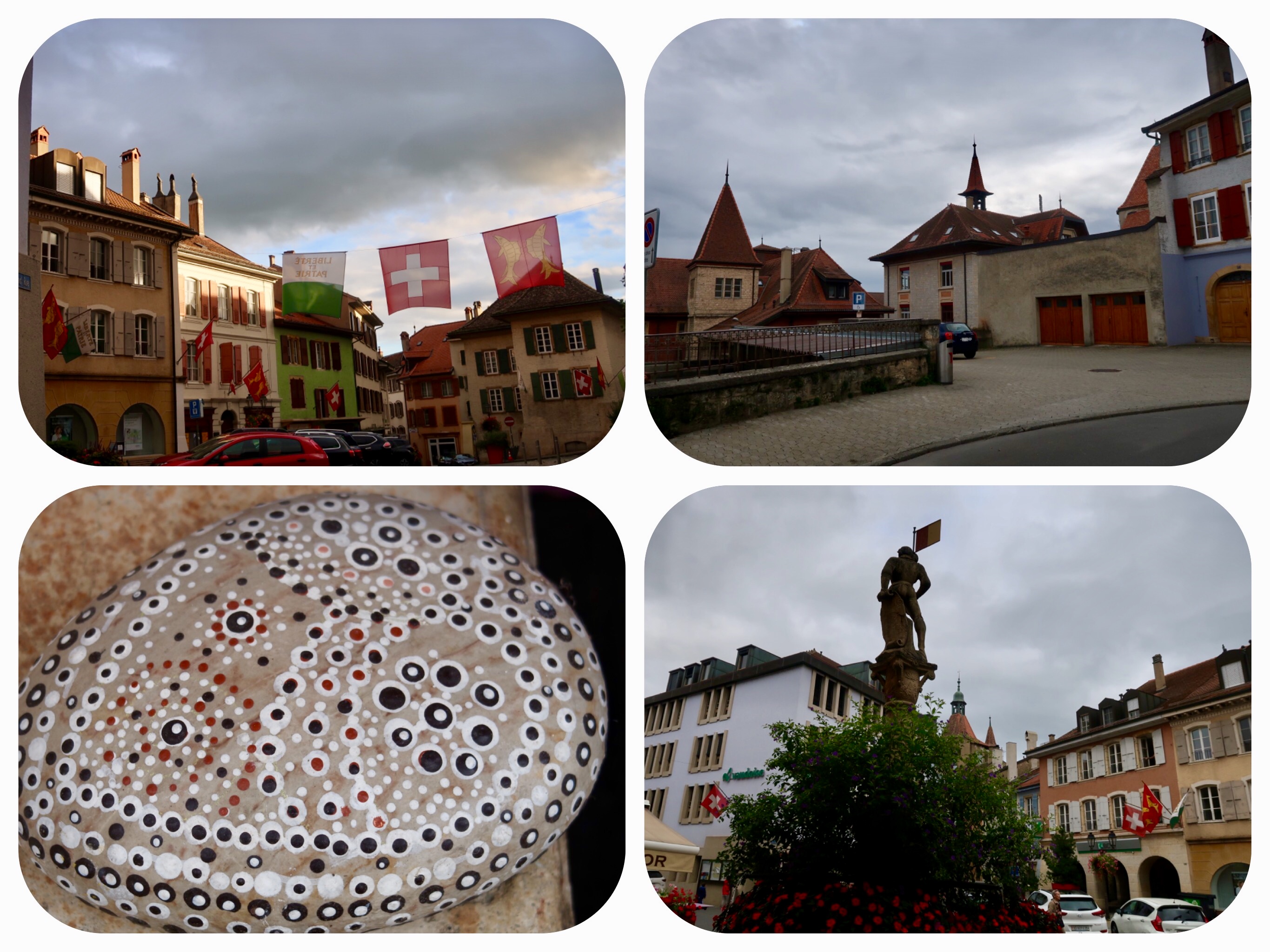
We finally reached Orbe before sunset.
The town looked picturesque, but everything was closed.
Our hotel looked a little Shabby, but I did not care.
I only wanted a hot shower and to lay down.
We had hiked a total time of nine hours, and as I explained to Jules, who seemed very disappointed that we would be paying $150 for a shabby hotel per night, there are NO other options in the town of Orbe.
Our room was decorated with plastic red poppy flowers attached arbitrarily to the walls with pins.
But despite the weird design, the room was well lit, the matters was good, the shower was hot and we had a heated towel rack, which allowed me to wash all our muddy clothes, socks, rain pants and shoes, and to get them all dried overnight.
The town has a Thai restaurant, and we slowly walked there after our shower, wearing our slippers.
The food was superb for an out of place Thai restaurant.
We enjoyed every dish we ordered and our only regret was that it would not be open tomorrow, because we planned to stay in Orbe for another night and visit the ancient Roman mosaics on the outskirts of town.
Today’s Stats:
Daily Steps - 42,895 Steps
9 hours of walking
Active walking time - 8 hours
Daily Kilometers - 31.5 Km
Total Kilometers walked from Canterbury UK - 994 km
Accommodation:
Hotel Restaurant Au Chasseur in Orbe.
A simple hotel (the only one in Orbe) with a hot shower, good heating, and a friendly and helpful owner.
To hear and see the cow’s parade, click here:
https://youtu.be/LPQXn_US4FY
Part 2:
https://youtu.be/1rcoN3sbgtI


