Day 46 - The Chūgoku 33 Temple Kannon Pilgrimage, Japan - A Most Scary and Dangerous Forest Hike to Gakuenji Temple, in the Mountains of Izumo


Day 46 - The Chūgoku 33 Temple Kannon Pilgrimage, Japan - A Most Scary and Dangerous Forest Hike to Gakuenji Temple, in the Mountains of Izumo
The symbol of Izumo is a dragon.
You can see this Dragon on every manhole cover, in advertisements and on posters around the city.
Today, the Dragon of Izumo held us briefly as captives, but we escaped from His mighty grasp unharmed.
It all started innocently enough, just a forest hike that suddenly went very wrong.
We had breakfast in our elegant Ryokan at the foot of the Izumo Taisha Shrine.
They made us a vegetarian breakfast with a printed menu of a collection of lovely choices.
Izumo is not a very urban looking city.
It has almost no tall buildings, and it is bordered on the north by a mountain range, which we climbed today.
On the western edge there are beaches, and the south is also mountainous, and one of our temples, which we have not yet visited, is located on a mountain to the south.
There are many rice fields within the city limits, and not much traffic at all.
The nicest part of town is around the Taisha Shrine.
The streets are paved with stone, and planted with trees, and two big Tori gates line the main street leading to the shrine.
The street is lined with traditional shops selling sweets, handmade soba noodles, dried seaweed and fish produce, and there are a few inns.
We will be staying in Izumo for four nights, which is barely enough to walk to the three Nansho (remote mountaintop) temples on our pilgrimage.
A Nansho temple is a temple located in a place that is difficult to get to.
It usually refers to mountaintop temples that are accessible only by a long hike or over a mountain pass.
As it turned out, three out of the four temples in Izumo are Nansho temples.
If it will take us all day long to walk to these temples, so we will barely have enough time to also visit the Taisha shrine and walk around the streets where we are staying.
This is not an ideal situation, and I was looking for a way to free up some time.
My “Pocket Earth” map showed that instead of getting to Gakuenji from the north along the car road, a hike of 25 kilometers, we could hike up the mountain from the south, on a forest hiking path.
There were three forest trails climbing from the south through the dense forest, all leading to Rakuenji temple.
The distance was indicated as roughly 6 kilometers up over the peak of the mountain and then down into a valley and up another peak.
I reasoned that even though it is a very steep forest hike, we are very experienced and can do the twelve kilometers up and down in half a day.
This would leave us plenty of time to visit the Taisha shrine and walk around the shrine area.
We headed to the mountain early.
I packed some snacks and four small bottles of water for both of us, thinking that it would be a breeze.
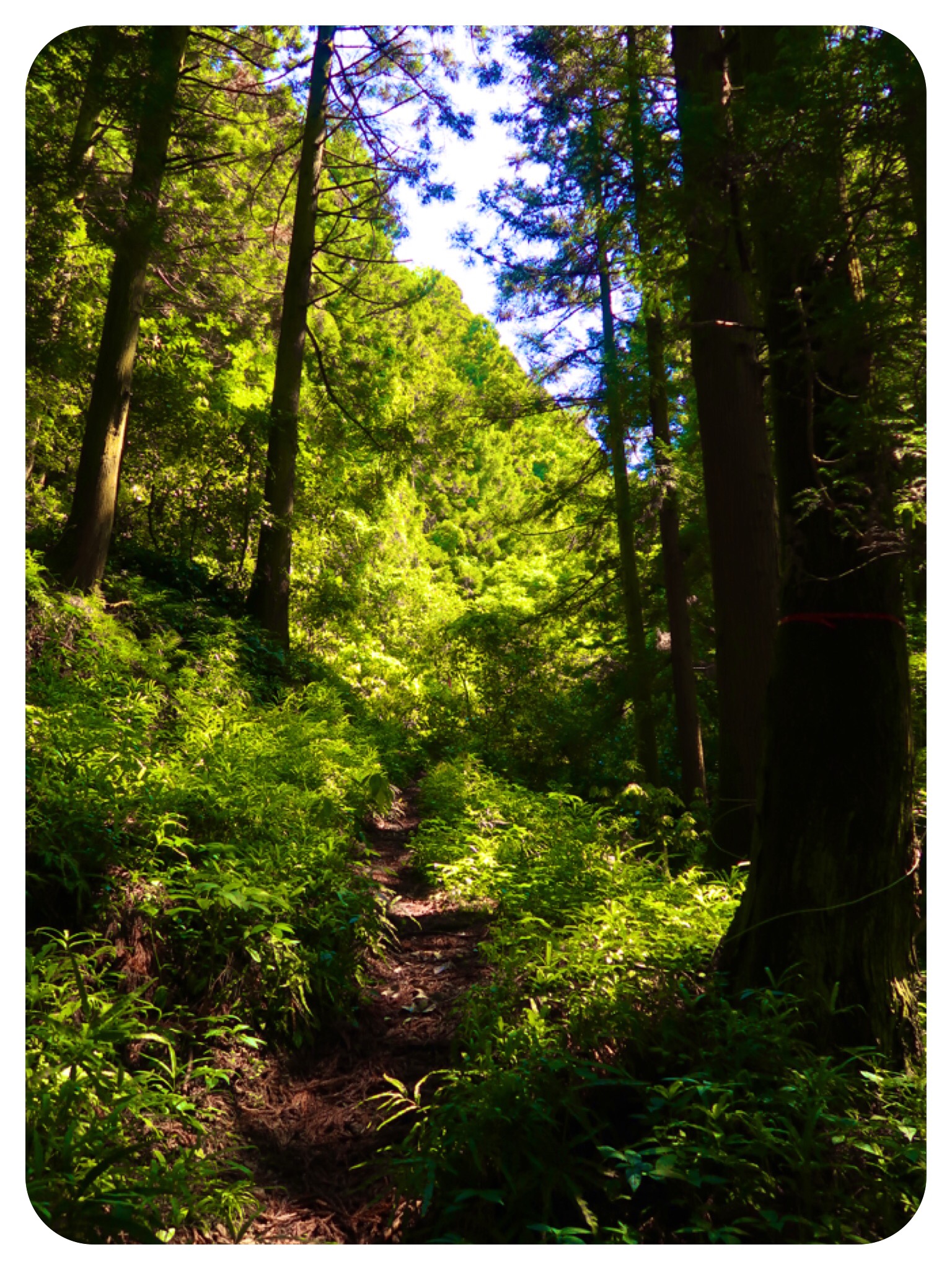
Looking at the steep mountain range, I prayed for help and guidance that there really would be a path through the dense forest.
From where we stood, it looked so steep and so dense....
I greeted a man working in his garden, just before we entered the forest.
He looked at us puzzled, unsure what we were doing there and where we were going.
I explained that we were planning to hike to Gakuenji temple through the mountains, and he nodded and pointed the way up, gesturing that it was a long way up.
The main reason I told him we were climbing is because locals usually would know if the road were closed and if the path still led to the temple.
His response was reassuring to me..
At least there was a path through the dense forest...
The path was very steep, so steep we only walked thirty or forty steps at a time, stopping to catch our breath and rest for a few seconds.
We climbed up and up, following the twists and turns of the forest path, climbing around rocks, over tree roots, fallen trees and forest leaves.
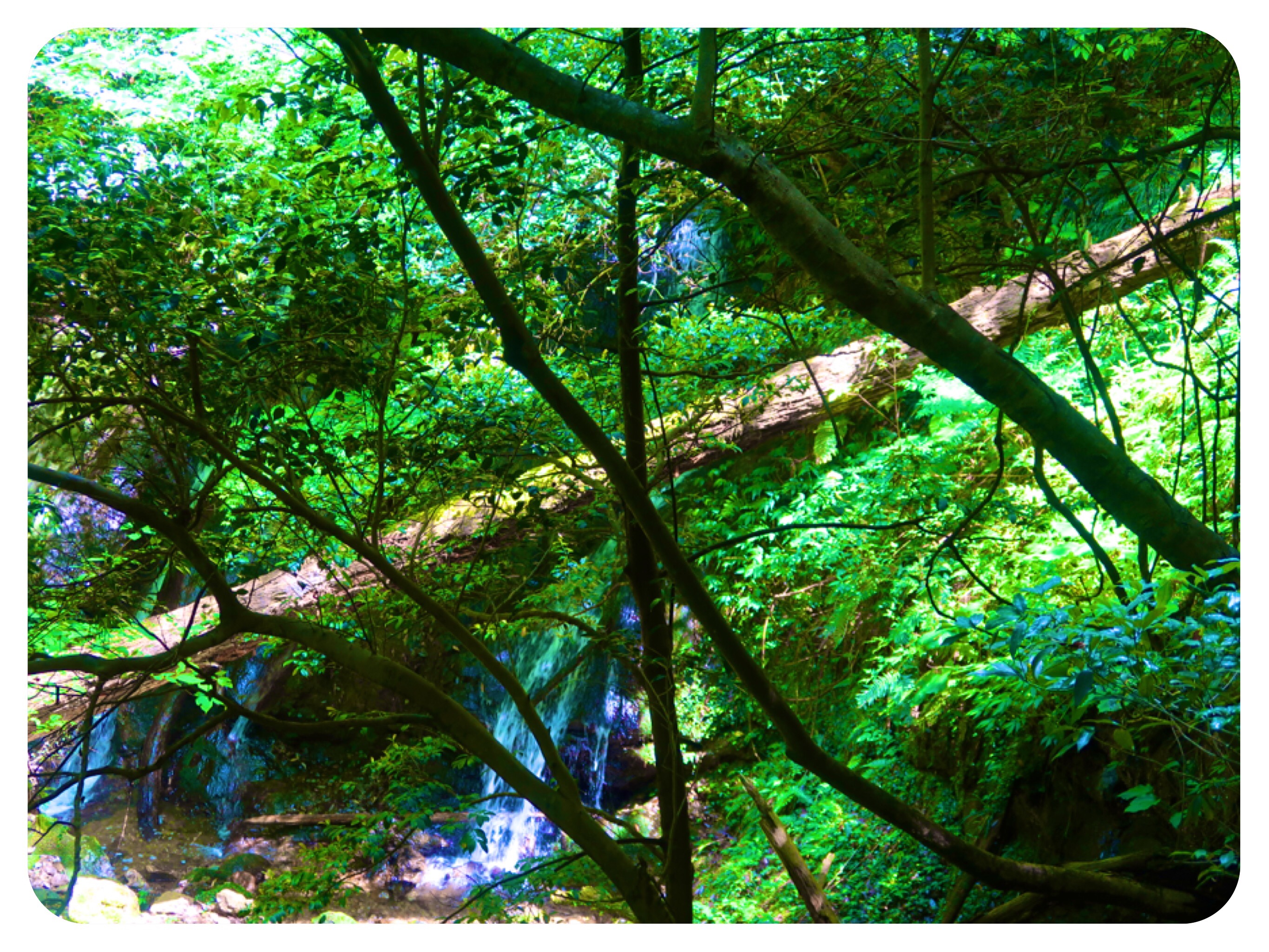
Birds were singing, waterfalls made splashing sounds, the river and creeks gurgled pleasantly.
We even saw signs, with arrows pointing to the path to Gakuenji temple along the way.
About an hour into our walk, we came upon a fence in the forest, closing the path.
We could not read what the Kanji (Chinese) characters said, and the gate was not locked, just latched.
Later I translated the signs and this was a warning not to start forest fires and an enclosure to protect deer.
We opened the latches and walked through, making sure to latch it again behind us.
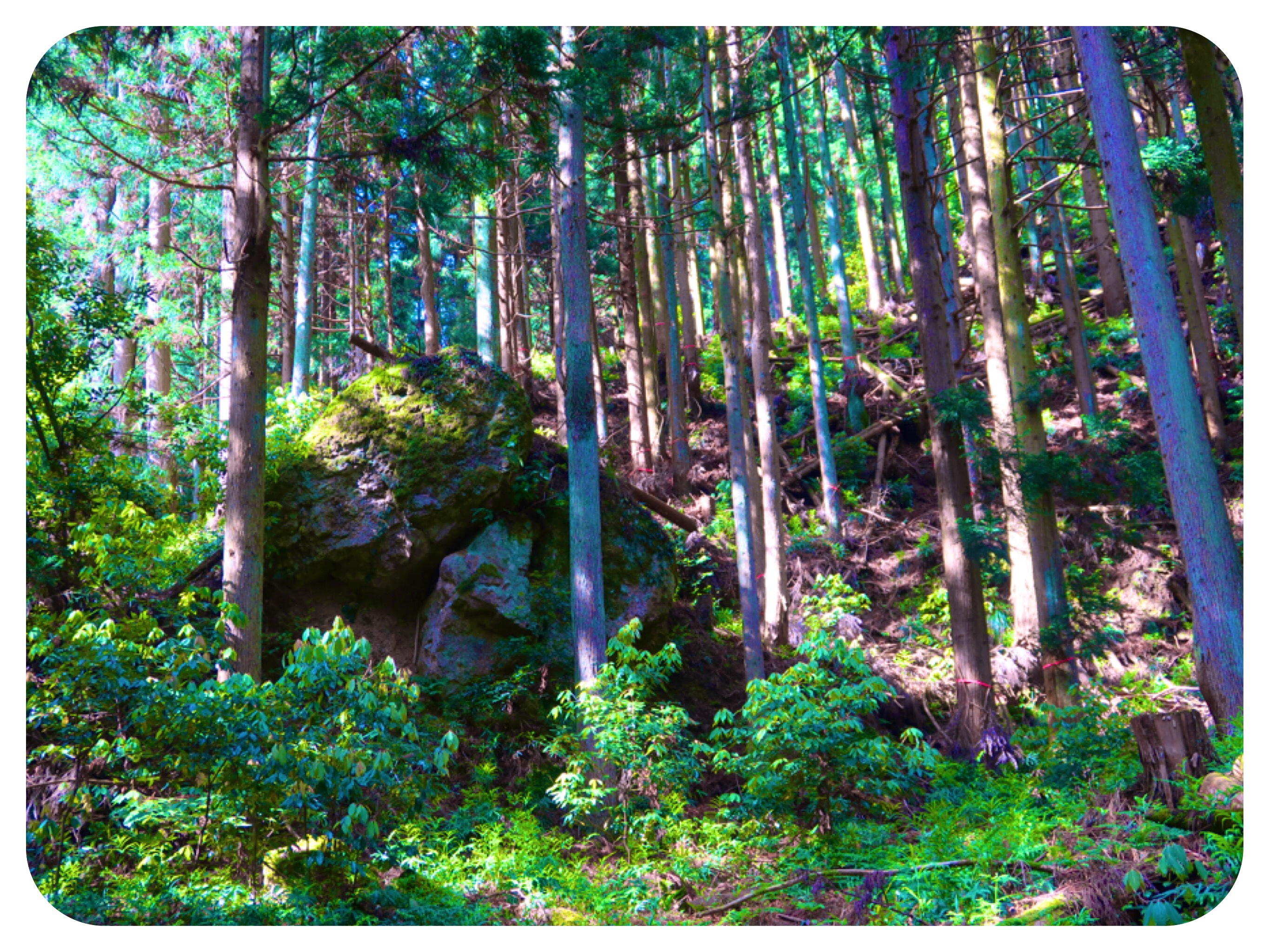
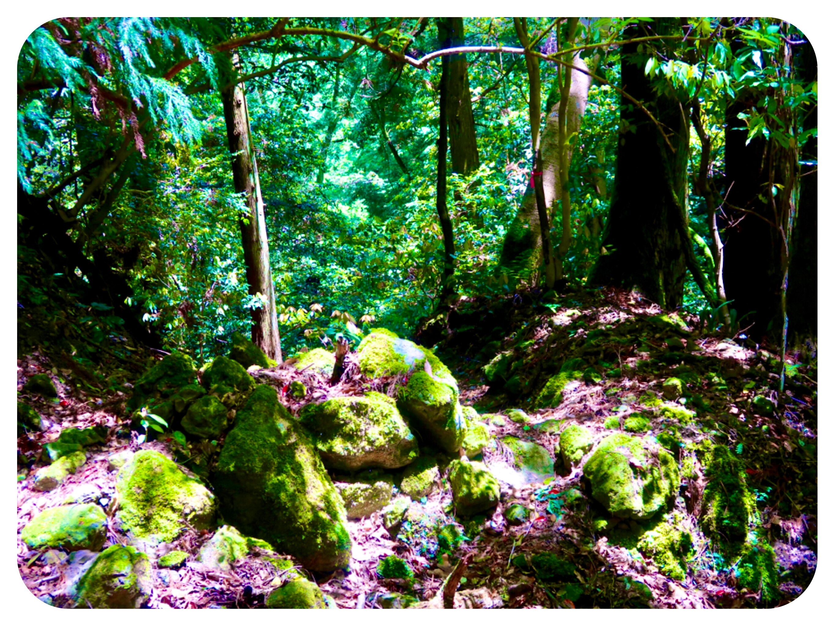
For another hour, the path was good, or at least as good as a non-maintained forest path could be.
There were rockslides and mudslides and fallen trees, and all the while we were climbing steeply up.
Then the path got much worse.
We no longer had clear indications of the trail, and we depended on my ‘Pocket Earth’ map to point us in the right direction.
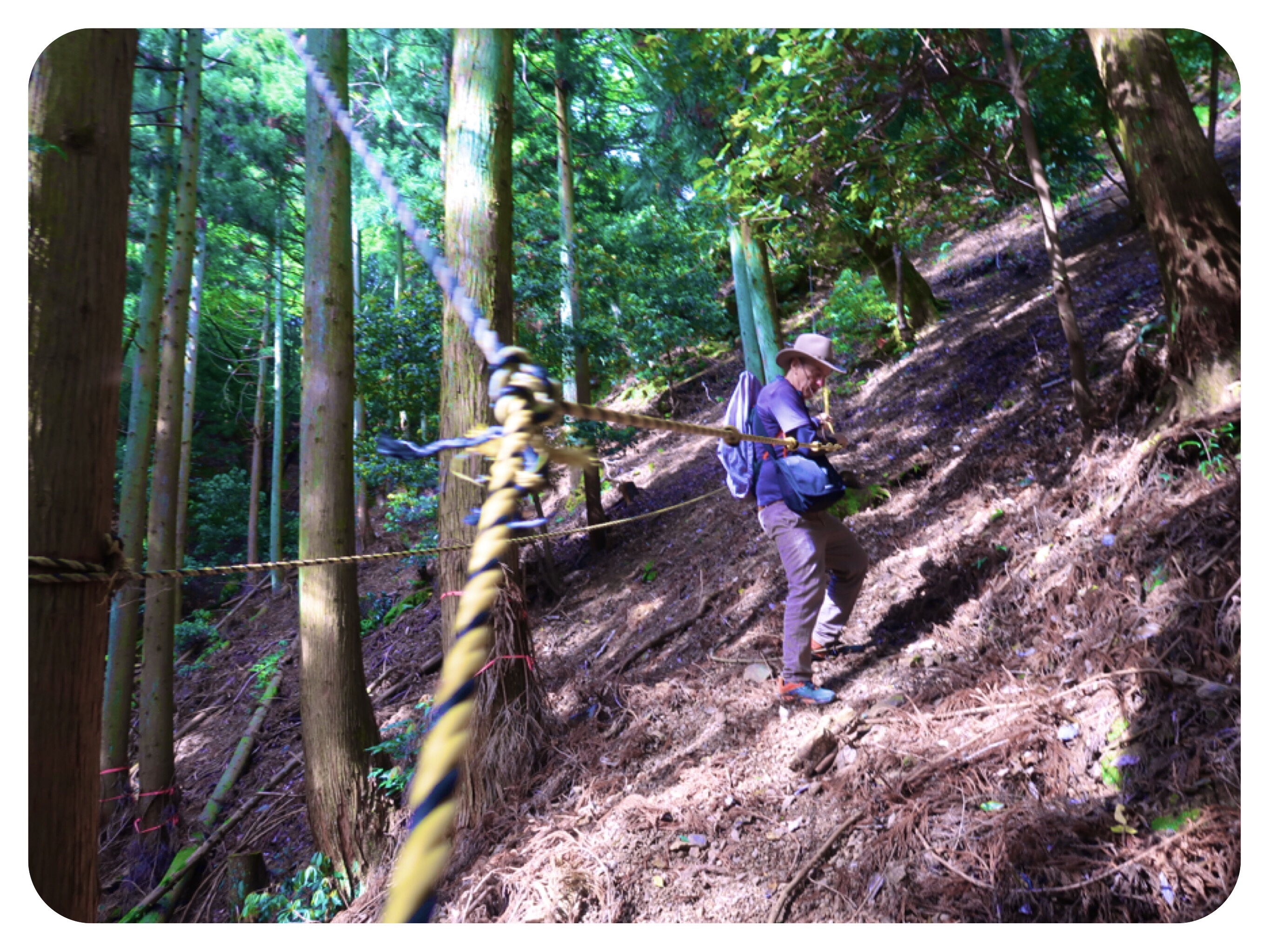
At times, we had to walk along very slippery, narrow trails, as it had just rained heavily the day before.
When I say narrow, I mean a trail that is barely one foot wide, and with no ropes to hold onto.
We held onto tree roots, vines and green young trees.
Most of the older trees branches were rotten and spongy.
The earth was not packed mud.
It was gravel and scree, and the wet, rotting leaves over the scree made it doubly slippery to walk on.
We had to calculate every step we took.
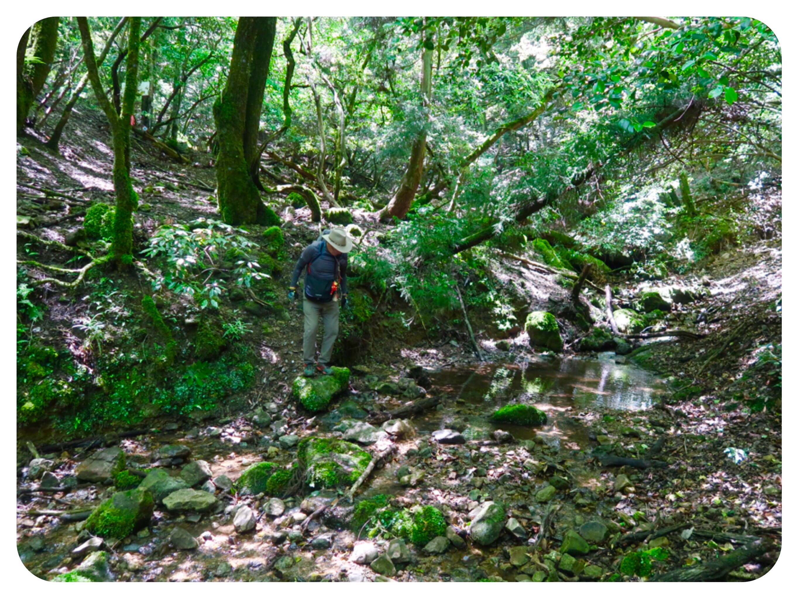
Two more hours passed, and we had to cross the river a few times, climbing over slippery rocks, fallen trees and broken branches.
At times, we could see the red ribbons marking the trail, tied to branches and trees.
At times, we saw no signs at all.
It was a really tough hike, as mudslides had washed out the already narrow path, and it was extremely slippery and precipitous, with barely a foothold to assist us as we walked over sheer cliffs above the waterfalls and the river, well below us.
At one point, we reached a huge black wall, oozing water and with vegetation and moss growing in its front.
It reminded me of a natural version of architecturally designed “Green Walls,” which were designed to bring a wall of vines and ferns to urban buildings.
Later, when I translated the Kanji character that I saw on the sign, it translated to “Death Wall.”
Beyond it, the trail disappeared completely.
We were unsure about how to continue.
I clambered over the cliff and looked farther west, but it was impossible to walk farther.
There was a steep wall going down to the rocky waterfalls far below.
We tried climbing up to the top of the ridge, dislodging rocks that rolled down to the waterfalls and crashed, making horrendous sounds.
From above, there was also no more way of walking towards the temple.
The next ridge was another black sheer wall with no way around it.
We thought to make our way down to the river, and to continue walking by the river.
It was not a good plan, but we felt fatigued and nearly desperate, although both of us kept our composure and did not show our desperation to the other in order not to discourage each other.
I was starting to feel fatigued, mostly because of fear.
While trying to walk up or forwards, we had a few times in which the scree and the tiny gravel below our feet crumbled, and if we did not hold on successfully to a tree, we would be sliding down the very steep precipice..
There were three times in which I had to pull myself up while hanging on to trees, when the scree below my feet crumbled down the cliffs.
The problem was that even though I was able to hold on to the trees and pull myself up, I had no more places with a secure foothold, so I could continue walking.
Jules started to slide down the hill, but he was able to hold on to a branch that slowed his sliding.
Then that branch snapped.
Jules slid down a little farther, but was able to grab onto another branch, and he pulled himself up.
We took a break and sat on a rock to drink some water and devise a strategy.
We decided that we should go down to the river after all.
At least we would be on ground level and would not again risk falling off the precipitous cliffs.
The nearest path down was the path of a dry waterfall.
It had broken rocks and places to place our feet, but only when we had tree roots to hold on to.
When we didn’t, it was really slippery and scary.
When the path got very difficult, I inched my way to have a look.
What I saw, sent chills up and down my spine.
We were going down a sheer rock cliff, on which a tall waterfall cascaded more than sixty feet down.
Later, when we had a better view from across the river, I saw that the rocky cliffs stretched for about fifty feet in each direction.
I did not want to scare Jules, who was slowly making his way down behind me.
I firmly said to Jules: “Turn back and climb up NOW!
Be very careful and mindful on your way up!
Make sure not to slide down.”
Later I told him how close we were to the ridge and we both saw how high the cliff was.
We talked it over.
On one hand, it felt foolish to decide to go back, when we had already walked most of the way to the temple on this path.
But we had no other choice.
We had already tried going up, down or continuing forwards, and they all were impossible.
The only way was to admit that we had to reverse our steps.
We were tired, it was getting late, and the path behind us was not easy at all. We had already crossed many difficult rockslides and it would not be an easy walk back.
But it was our only choice.
We took deep breaths to renew our achy muscles, and made our way slowly back, holding on to whatever we could grab.
Our hiking gloves, clothing and day packs, were covered in mud.
Only about half a kilometer from where we had decided to reverse our steps, we saw a sign, hidden in the woods, that we had missed before.
It was directing us towards the temple, not by continuing on the path we had walked on towards Death Wall, but by crossing the river and picking up the path on the other side.
We took more deep breaths and felt relieved, although this new path was not an easy one either.
It was washed out in places, and had no ropes to help us cross over the scree, but at least it was the right path.
I was tired and achy, but relieved.
Before the path ended up on a forest road, we had to take off our shoes and cross the river barefoot, because the stone bridge that used to be there, had collapsed decades ago.
We ended up at the temple, covered in mud, with dry leaves caught in our hats.
At the temple’s office the woman who stamped our book said we must not use the trail we had taken to go back.
“It is impossible!!!,” she said adamantly.
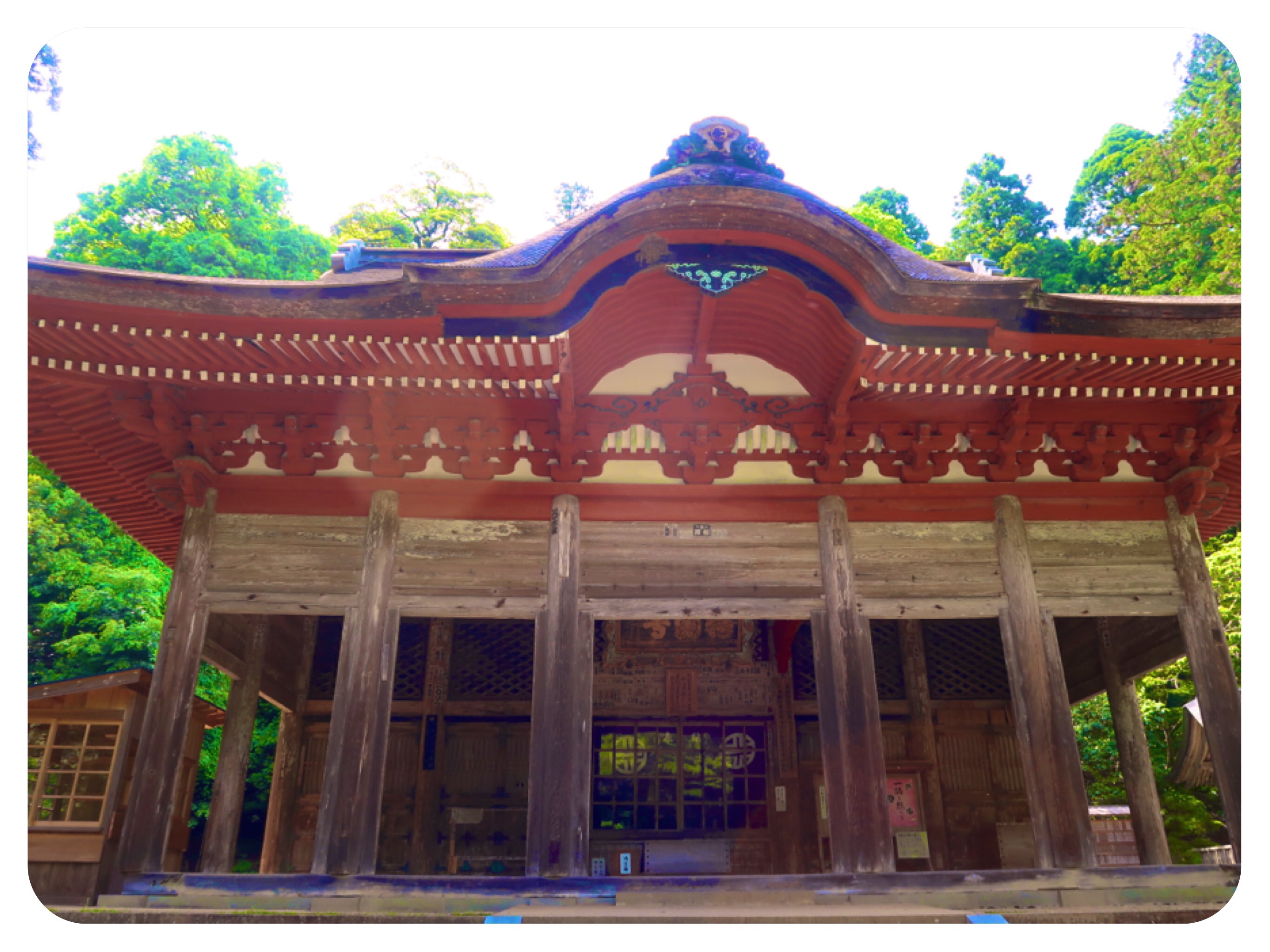
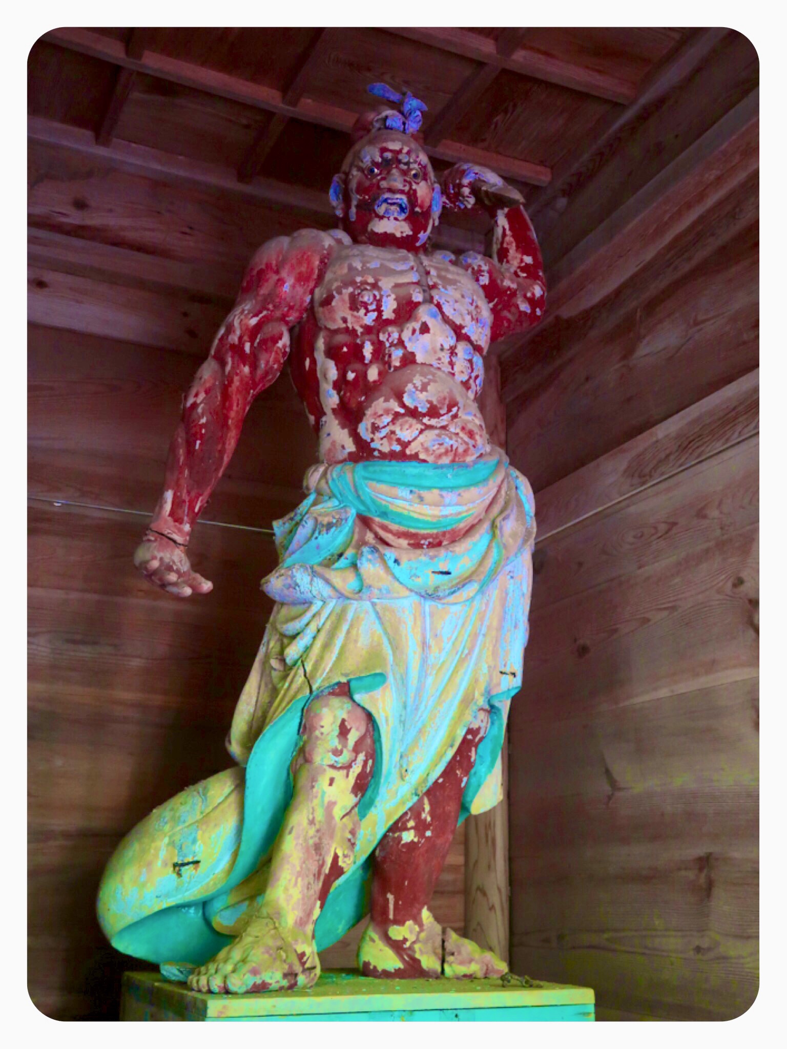
The temple is a Zen temple of the Tendai sect, and they charged a fee of ¥500 per person to get in.
Most of it was closed due to renovations, but we did not mind.
The main hall is up a steep set of stairs.
There are hiking poles available to borrow, for visitors.
We saw a young man take a pole and slowly make his way up.
After all we had been through today, the steep steps felt luxurious.
At least we had strong stone steps under our feet.
We enjoyed the beautiful old main hall and rested in the shade of the old trees.
We drank all the water in our water bottles, and ate all the snacks we had brought with us.
The temple’s priest came over to talk with us.
He gave us a hiking map and said it would be best if we returned via another route.
He suggested we climb up to the summit, on a trail that turned into the forest right after we exited the temple’s gate.
After the summit, he said we can rejoin the trail we came on, at a better spot.
But I knew that there was no better spot in the trail we had come on.
It was already 3PM and we did not have enough time to spend another five hours in the forest climbing over mudslides.
It was obvious to me that not many people had hiked this path.
I followed the first part of his suggestion, and we climbed up to the summit on the steep trail, but from there we continued south and joined an old unused road, which took us out of the forest.
It was a very steep climb to get up to the summit.
We climbed up and up, and my body felt achy.
Jules looked tired too, but we made it.
From the summit, the walk down was slippery on layers of rotten leaves.
Mount Hanatakasen’s summit is 1804 feet (550 meters), but we had to go down another ridge twice before reaching the temple, and then up again to the summit and down to Izumo.
In the spots where this path was washed away, there were always ropes to hold onto.
It would have been great if we had arrived on this path also.
I only regretted that we had no more water with us on the steep climb up, but we took deep breaths, filling up our lungs, which helped to renew us.
It was getting near dusk, and the moss covered giant trees growing sideways with their branches resembled a dragon with tentacles, to my tired mind.
But we knew that we were safe and had made it out of the clutches of the Izumo Dragon safely.
By the time we made it back to the Taisha Shrine area where we are staying, only the Starbucks was open.
All the shops and restaurants had closed.
Our dinner was two Onigiri rice balls each, and tea with a cookie at the Starbucks.
The onsen that night was very renewing.
I did not even want to think about the fact that we will have to climb another Nansho tomorrow.....
With love and many blessings,
Tali
Daily Stats:
Steps: 28,481 steps
Distance Walked: 21 Kilometers
Active Walking: 6.5 hours
Total Time: 8 hours
Total distance walked on the pilgrimage so far: 945.5 Kilometers
Temple Visited: Temple #25, Gakuenji Temple 鰐淵寺
Accommodation: Takenoya Ryokan Kiunso.
A traditional renovated Onsen Ryokan, in Izumo next to the famous Izumo Taisha Shrine.
Elegant traditional hospitality, has an indoor hot spring bath, very spacious tatami mat rooms.
It offers a pricy and elegant Kaiseki dinner which we did not take, and a very good breakfast.


